Location: Western Africa, bordering the Gulf of Guinea, between Cote d'Ivoire and Togo
Geographic coordinates: 8 00 N, 2 00 W
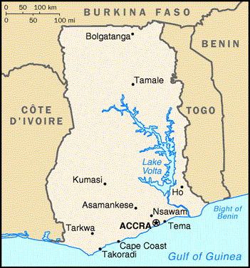
Map references: Africa
Area:
total: 238,540 sq km
land : 230,020 sq km
water: 8,520 sq km
Area - comparative: slightly smaller than Oregon
Land boundaries:
total: 2,093 km
border countries: Burkina Faso 548 km, Cote d'Ivoire 668 km, Togo 877 km
Coastline: 539 km
Maritime claims:
contiguous zone: 24 nm
continental shelf : 200 nm
exclusive economic zone: 200 nm
territorial sea: 12 nm
Climate: tropical; warm and comparatively dry along southeast coast; hot and humid in southwest; hot and dry in north
Terrain: mostly low plains with dissected plateau in south-central area
Elevation extremes:
lowest point: Atlantic Ocean 0 m
highest point: Mount Afadjato 880 m
Natural resources: gold, timber, industrial diamonds, bauxite, manganese, fish, rubber
Land use:
arable land: 16%
permanent crops : 7%
other: 77% (1998 est.)
Irrigated land: 110 sq km (1998 est.)
Natural hazards: dry, dusty, harmattan winds occur from January to March; droughts
Environment - current issues: recent drought in north severely affecting agricultural activities; deforestation; overgrazing; soil erosion; poaching and habitat destruction threatens wildlife populations; water pollution; inadequate supplies of potable
water
Environment - international agreements:
party to : Biodiversity, Climate Change, Endangered Species, Environmental Modification, Law of the Sea, Nuclear Test Ban, Ozone Layer Protection, Ship Pollution, Tropical Timber 83, Tropical Timber 94, Wetlands, Whaling
signed, but not ratified: Desertification, Marine Life Conservation
Geography - note: Lake Volta is the world's largest artificial lake; northeasterly harmattan wind (January to March)
Population: 20,244,154
Age structure:
0-14 years: 40.4% (male 4,116,600; female 4,063,654)
15-64 years: 56.1% (male 5,625,397; female 5,723,786)
65 years and over : 3.5% (male 338,352; female 376,365) (2002 est.)
Population growth rate: 1.7% (2002 est.)
Birth rate: 28.08 births/1,000 population (2002 est.)
Death rate: 10.31 deaths/1,000 population (2002 est.)
Net migration rate: --0.74 migrant(s)/1,000 population (2002 est.)
Sex ratio:
at birth : 1.03 male(s)/female
under 15 years: 1.01 male(s)/female
15-64 years: 0.98 male(s)/female
65 years and over: 0.9 male(s)/female
total population: 0.99 male(s)/female (2002 est.)
Infant mortality rate: 55.64 deaths/1,000 live births (2002 est.)
Life expectancy at birth:
total population: 57.06 years
male : 58.51 years (2002 est.)
female:58.51 years (2002 est.)
Total fertility rate: 3.69 children born/woman (2002 est.)
Nationality:
noun: Ghanaian(s)
adjective: Ghanaian
Ethnic groups:black African 98.5% (major tribes - Akan 44%, Moshi-Dagomba 16%, Ewe 13%, Ga 8%, Gurma 3%, Yoruba 1%), European and other 1.5% (1998)
Religions: indigenous beliefs 21%, Muslim 16%, Christian 63%
Languages: EEnglish (official), African languages (including Akan, Moshi-Dagomba, Ewe, and Ga)
Literacy:
definition: age 15 and over can read and write
total population: 64.5%
male: 75.9%
female : 53.5% (1995 est.)
Country name:
conventional long form: Republic of Ghana
conventional short form: Ghana
former: Gold Coast
Data code: GH
Government type: constitutional democracy
National capital: Accra
Administrative divisions: 10 regions; Ashanti, Brong-Ahafo, Central, Eastern, Greater Accra, Northern, Upper East, Upper West, Volta, Western
Independence: 6 March 1957 (from UK)
National holiday: Independence Day, 6 March (1957)
Constitution: new constitution approved 28 April 1992
Legal system: based on English common law and customary law; has not accepted compulsory ICJ jurisdiction
Suffrage: 18 years of age; universal
Executive branch:
chief of state: President John Agyekum KUFUOR (since 7 January 2001); Vice President Alhaji Aliu MAHAMA (since 7 January 2001); note - the president is both the chief of state and head of government
head of government: President John Agyekum KUFUOR (since 7 January 2001); Vice President Alhaji Aliu MAHAMA (since 7 January 2001); note - the president is both the chief of state and head of government
cabinet : Council of Ministers; president nominates members subject to approval by the Parliament
elections:president and vice president elected on the same ticket by popular vote for four-year terms; election last held 7 and 28 December 2000 (next to be held NA December 2004)
election results: John Agyekum KUFUOR elected president in runoff election; percent of vote - John KUFUOR 56.4%, John Atta MILLS 43.6%
Legislative branch: unicameral Parliament (200 seats; members are elected by direct, popular vote to serve four-year terms)
elections : last held 7 December 2000 (next to be held NA December 2004)
election results: percent of vote by party - NA%; seats by party - NPP 100, NDC 92, PNC 3, CPP 1, independents 4
Judicial branch: Supreme Court
Political parties and leaders:Convention People's Party or CPP [Nii Noi DOWUONA, general secretary]; Every Ghanaian Living Everywhere or EGLE [Owuraku AMOFA, chairman]; Great Consolidated Popular Party or GCPP [Dan LARTY]; National Convention Party or NCP [Sarpong KUMA-KUMA]; National Democratic Congress or NDC [Dr. Huudu YAHAYA, general secretary]; New Patriotic Party or NPP [Samuel Arthur ODOI-SYKES]; People's Convention Party or PCP [P. K. DONKOH-AYIFI, acting chairman]; People's Heritage Party or PHP [Emmanuel Alexander ERSKINE]; People's National Convention or PNC [Edward MAHAMA]; Reform Party [Kyeretwie OPUKU, general secretary]
International organization participation: ACP, AfDB, C, CCC, ECA, ECOWAS, FAO, G-24, G-77, IAEA, IBRD, ICAO, ICFTU, ICRM, IDA, IFAD, IFC, IFRCS, ILO, IMF, IMO, Inmarsat, Intelsat, Interpol, IOC, IOM (observer), ISO, ITU, MINURSO, NAM, OAU, UN, UNCTAD, UNESCO, UNIDO, UNIFIL, UNIKOM, UNMIBH, UNMOP, UNPREDEP, UNTAES, UNU, UPU, WCL, WFTU, WHO, WIPO, WMO, WToO, WTrO
Diplomatic representation in the US:
chief of mission: Ambassador Alan J. KYEREMATEN
chancery: 3512 International Drive NW, Washington, DC 20008
telephone: [1] (202) 686-4520
FAX : [1] (202) 686-4527
consulate(s) general: New York
Diplomatic representation from the US:
chief of mission: Ambassador Nancy J. POWELL
embassy: Ring Road East, East of Danquah Circle, Accra
mailing address: P. O. Box 194, Accra
telephone: [233] (21) 775348
FAX: [233] (21) 775747
Flag description: three equal horizontal bands of red (top), yellow, and green with a large black five-pointed star centered in the yellow band; uses the popular pan-African colors of Ethiopia; similar to the flag of Bolivia, which has a coat of arms centered in the yellow band
Economy - overview: Well endowed with natural resources, Ghana has roughly twice the per capita output of the poorer countries in West Africa. Even so, Ghana remains heavily dependent on international financial and technical assistance. Gold, timber, and cocoa production are major sources of foreign exchange. The domestic economy continues to revolve around subsistence agriculture, which accounts for 36% of GDP and employs 60% of the work force, mainly small landholders. Excessively expansionary monetary and fiscal policy prior to the 2000 elections led to accelerating inflation in early 2001. A depressed cocoa market and continued weak growth in non-traditional exports led to disappointing growth in 2001. Ghana opted for debt relief under the Heavily Indebted Poor Country (HIPC) program in 2002.
GDP: purchasing power parity - $39.4 billion (2001 est.)
GDP - real growth rate: 3% (2001 est.)
GDP - per capita: purchasing power parity - $1,980 (2001 est.)
GDP - composition by sector:
agriculture : 36%
industry:25%
services: 39% (2000 est.)
Inflation rate - consumer price index: 25% (2001 est.)
Labor force:
total:9 million (2000 est.)
by occupation: agriculture 60%, industry 15%, services 25% (1999 est.)
Unemployment rate: 20% (1997 est.)
Budget:
revenues: $1.603 billion
expenditures: $1.975 billion, including capital expenditures of $NA (2001 est.)
Industries: mining, lumbering, light manufacturing, aluminum, food processing
Industrial production growth rate: 3.8% (2000 est.)
Electricity - capacity: 1.19 million kW (1994)
Electricity - production: 5.92 billion kWh (2000)
Electricity - consumption per capita: 5.484 billion kWh (2000)
Agriculture - products: cocoa, rice, coffee, cassava (tapioca), peanuts, corn, shea nuts, bananas; timber
Exports:
total value: $1.94 billion (f.o.b., 2000)
commodities: gold 39%, cocoa 31%, timber 6%, tuna, bauxite, aluminum, manganese ore, and diamonds (1994 est.)
partners: Togo, UK, Italy, Netherlands, Germany, US, France (1998)
Imports:
total value: $1.84 billion (c.i.f., 1995)$2.83 billion (f.o.b., 2000)
commodities: capital equipment, petroleum, consumer goods, foods, intermediate goods
partners : UK, Nigeria, US, Germany, Italy, Spain (1998)
Debt - external: $5.96 billion (2001 est.)
Economic aid:
recipient: $6.9 billion (1999)
Currency: 1 new cedi (C) = 100 pesewas
Exchange rates: cedis per US dollar - 7,195 (January 2002), 7,170.76 (2001), 5,455.06 (2000), 2,669.30 (1999), 2,314.15 (1998), 2,050.17 (1997)
Fiscal year: calendar year
Telephones: 240,000 (2001)
Telephone system:poor to fair system; Internet accessible; many rural communities not yet connected; expansion of services is underway
domestic: primarily microwave radio relay; wireless local loop has been installed
international :satellite earth stations - 4 Intelsat (Atlantic Ocean); microwave radio relay link to Panaftel system connects Ghana to its neighbors
Radio broadcast stations: AM 0, FM 49, shortwave 3 (2001)
Radios: 12.5 million (2001)
Television broadcast stations:10 (2001)
Televisions: 1.9 million (2001)
Railways:
total: 953 km (undergoing major renovation)
narrow gauge : 953 km 1.067-m gauge (2001 est.)
Highways:
total: 38,940 km
paved: 9,346 km (including 30 km of expressways)
unpaved: 29,594 km (2001)
Waterways: 1,293 km
noteVolta, Ankobra, and Tano Rivers provide 168 km of perennial navigation for launches and lighters; Lake Volta provides 1,125 km of arterial and feeder waterways
Pipelines: 0 km
Ports and harbors: Takoradi, Tema
Merchant marine:
total : 7 ships (1,000 GRT or over) totaling 16,450 GRT/22,097 DWT
ships by type: petroleum tanker 2, refrigerated cargo 5
Airports: 12 (2001)
Airports - with paved runways:
total : 7
2,438 to 3,047 m:1
1,524 to 2,437 m: 4
914 to 1,523 m: 2 (2001)
Airports - with unpaved runways:
total: 5
1,524 to 2,437 m: 1
914 to 1,523 m: 2
under 914 m:2 (2001)
Military branches: Army, Navy, Air Force, Police Force, Palace Guard, Civil Defense
Military manpower - military age: 18 years of age
Military manpower - availability:
males age 15-49: 5,045,355 (2002 est.)
Military manpower - fit for military service:
males: 2,799,292 (2002 est.)
Military manpower - reaching military age annually:
males : 213,237 (2002 est.)
Military expenditures - dollar figure: $35.2 million (FY01)
Military expenditures - percent of GDP: 0.7% (FY01)
Disputes - international: none
Illicit drugs: illicit producer of cannabis for the international drug trade; transit hub for Southwest and Southeast Asian heroin and South American cocaine destined for Europe and the US
|